

On 21 October, Wiltshire Council adopted a pivotal planning document following a public consultation in the spring. It sets out how the landscapes around Stonehenge and Avebury will continue to be protected for future generations to experience and understand.
This new Supplementary Planning Document (SPD) will now inform decisions for proposed developments that may affect the setting of the Neolithic and Bronze Age monuments and the two unparalleled archaeological landscapes – recognised by UNESCO for their international significance.
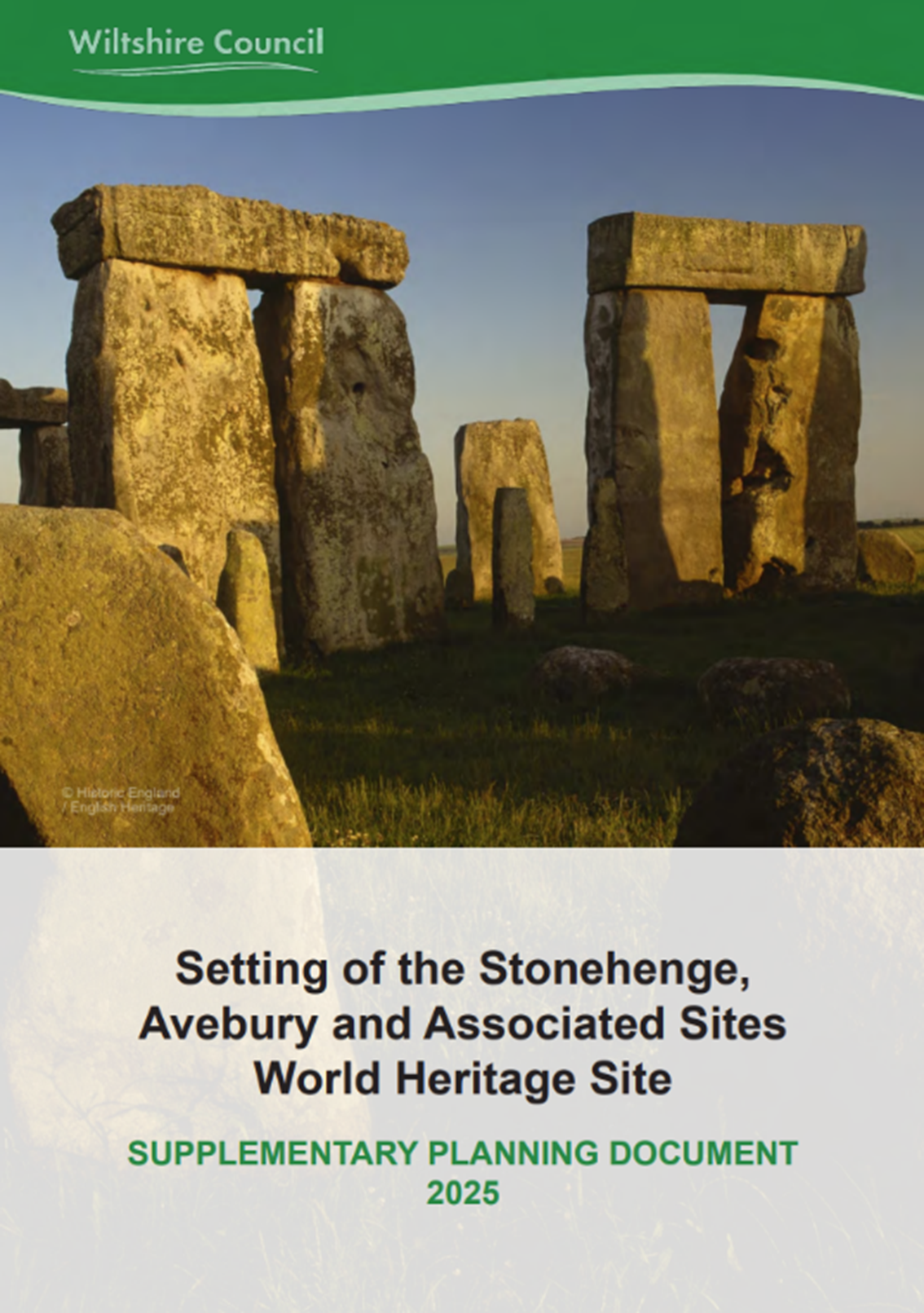
You can read the adopted document in full here.
Why is “setting” important?
When we experience prehistoric monuments and ceremonial landscapes, their surroundings can often affect how we appreciate the significance and value of the archaeological remains. That is why protecting the setting is a key priority for the Stonehenge & Avebury World Heritage Site Partnership.
The adopted SPD outlines how planning applications may affect the setting of the World Heritage Site and which of them require further assessment of their potential impacts. The planning process takes much more into account than simply just how geographically close a proposed development is to the monuments of Stonehenge and Avebury.
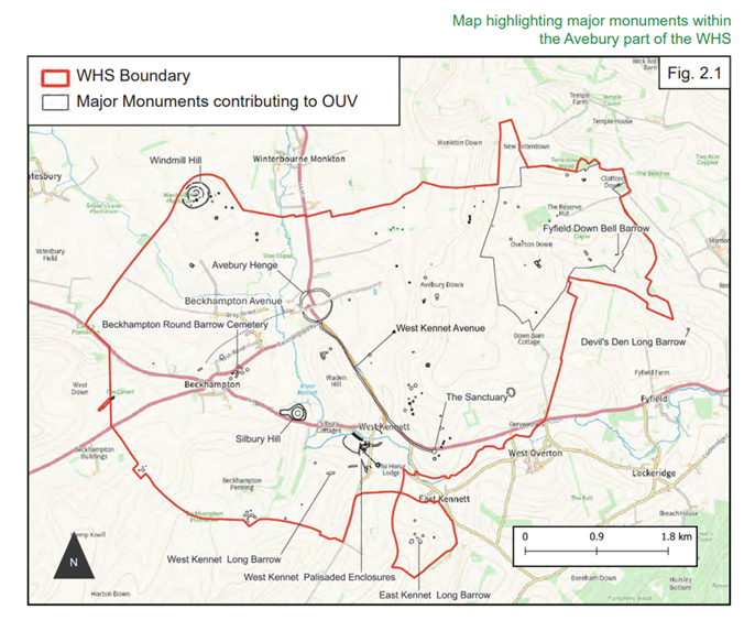
There are many considerations central to the setting including the relationships of the monuments to each other, to the natural topography, to rivers and water, and to the skies and astronomy. The document is not only a necessary tool for the planning process, but a highly useful resource for anyone interested in studying these archaeological landscapes in greater detail.
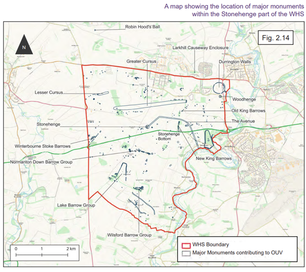
How do we experience the landscapes?
Like many other chalk downlands of southern Britain, both parts of the World Heritage Site are largely open landscapes and are strongly rural in character. They include areas of important species-rich grassland, helping to conserve both nature and the archaeological remains.
The natural topography generally shapes visibility, due to the limited woodland, vegetation and buildings, and so also shapes how we experience the monuments in their landscapes. Gently rising downs, open plains, and prominent ridgelines, all in different ways, limit and enable views across the World Heritage Site.
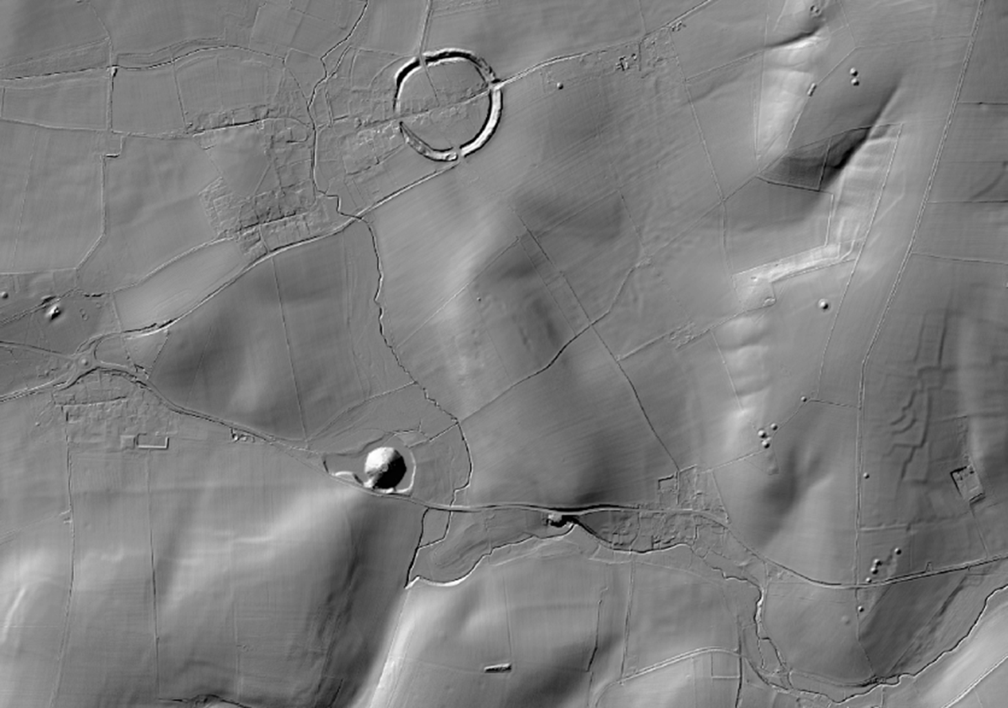
Digital Terrain Model of the Avebury landscape (LiDAR Composite 1m). © Environment Agency
What defines the Avebury landscape most is the sheer monumentality and presence of the Neolithic monuments within it. Silbury Hill “pops up” in different views as you travel around the surrounding area, though it dominates its local landscape and imposes itself behind the earlier-constructed West Kennet Long Barrow.

Silbury Hill beyond West Kennet Long Barrow. © English Heritage
And as you move along the West Kennet Avenue, it’s only towards its northern end that the topography reveals the sheer scale of the banks, ditches and stones of Avebury Henge, which remarkably contrast with the village.
In the Stonehenge landscape, one thing you may notice when looking out from the globally iconic Neolithic monument is that you are surrounded by a defined ring of natural ridgelines. These elevated positions were later utilised by Bronze Age builders to accentuate their barrows, such as on Normanton Down to the south, or on King Barrow Ridge to the east. This prehistoric skyline is at the heart of how we today appreciate and understand the hundreds of monuments in the Stonehenge landscape.
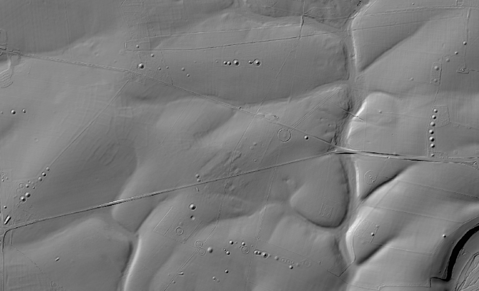
Digital Terrain Model of the Stonehenge landscape (LiDAR Composite 1m). © Environment Agency
Another critical aspect of the setting is related to the rivers and water. Both Stonehenge and Durrington Walls are physically connected to the River Avon by ‘avenues’ of different lengths. And seasonal watercourses along the dry valleys would have influenced how monuments were positioned in prehistory.
Perhaps one of the most famous aspects of the Stonehenge landscape is the design of several monuments in relation to the skies and astronomy. The Stonehenge, Woodhenge and Durrington Walls monuments were all carefully sited and intricately designed to align with key solar and lunar events. The experience of these astronomical alignments continues to be highly valued today as many thousands of people observe the solstices each year at Stonehenge.
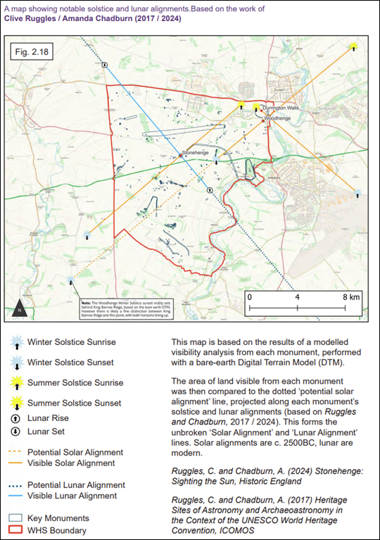
Astronomy (pg. 107) in the Supplementary Planning Document (SPD).
What else is in the document?
The new SPD brings together national and international guidance – from UNESCO, Historic England and the National Planning Policy Framework – to provide clear advice for planners, developers, applicants, and consultees. It includes descriptions and mapping of many locations in the landscapes that are particularly important when it comes to making decisions on planning applications. These include locations on or close to sensitive ridgelines or key astronomical alignments, among many others.
The document is well worth dipping into if you’d like to find out more about the unparalleled landscapes of Stonehenge and Avebury. You can read it here.
George Downs
World Heritage Site Partnership Officer
For more details, please contact the WHS Coordination Unit: stonehengeandaveburywhs@wiltshire.gov.uk
Share this post
About Us
Research Tools
What We Do
Contact us
Wiltshire and Swindon History Centre
Cocklebury Road
Chippenham
SN15 3QN
E: heritageadmin@wiltshire.gov.uk
T: 01249 705500


